Project Overview
NTH was retained by DTE for engineering and consulting services to conduct a shoreline inspection at the Delray Park Detroit River Fishing Access Site located along the Detroit River in Detroit, Michigan. The inspection includes documentation of the current shoreline condition above and below the water level and the preparation of an engineering report.
Project Scope
NTH has been performing services, including review of existing information for the facility, a shoreline evaluation performed both above and below the water surface to visually survey the existing shoreline system, a geotechnical investigation to determine the general subsoil and groundwater information, and an engineering report summarizing our findings from the shoreline evaluation to meet the requirements of the City of Detroit Waterbody Ordinance.
NTH has performed work at various locations throughout Delray Park, including:
Waterman Substation
DTE converted the Waterman Power Plant from a coal-fired power plant in the 1970’s and now uses the facility as a Peaker plant fueled by natural gas. The former dock on the Detroit River is now open to the public for fishing in a cooperative agreement with the State of Michigan Department of Natural Resources. The shoreline systems are comprised of steel sheet piling along the former intake canal repurposed as a boat ramp, a pile supported wharf along the Detroit River frontage repurposed as a fishing pier, and a combination of steel sheet pile and riprap shoreline at the former outfall canal.
Based on observations, the existing fishing pier was likely a timber pile supported wharf system, the site has been filled at the river’s edge on the order of 18 inches, and the center of the wharf is slightly bowed towards the river relative to the ends. Additionally, a three foot diameter area of ground subsidence is located at the downstream end of the wharf, adjacent to the open water where a previous wharf has been removed. The edge of the ground subsidence has a geotextile fabric at a depth of one to two feet.
Following the shoreline inspection performed in 2022, NTH issued the shoreline report indicating five (5) sinkholes currently exist at the site and a limited number of immediate repairs were required within the next 6 to 18 months. Within the Shoreline Report, preliminary repair concepts were presented for each of the shoreline structures that required repairs. Due to concerns about seawall deterioration and the continuing appearance of sinkholes behind the existing Delray Park seawalls, DTE has requested that NTH identify repair options and cost estimates for three asset maintenance strategies.
Delray Substation
The approximately 33.5-acre Delray Substation Site is located at the site of the former Delray Power Plant between Jefferson Avenue and the Detroit River at Rademacher Street in Detroit, Michigan. The Delray Substation Site is currently bounded by Fort Wayne to the east (upstream) and a Lafarge cement terminal to the west (downstream). The Delray Power Plant was constructed as a coal-fired power plant in 1903 which was converted into a peaker plant fueled by natural gas in the 1970s. Between 1981 and 1997, the power plant was demolished and much of the site has been fenced off. The remainder of the site was then opened to the public for fishing and river access in a cooperative agreement between DTE and the State of Michigan Department of Natural Resources, currently known as the Delray Park Detroit River Fishing Access Site. The existing park space extends from the former eastern intake canal dock downstream along the Detroit River to the former outfall canal, with a total length of approximately 650 ft along the Detroit River. In addition to Detroit River frontage, the former intake canal was repurposed as a boat ramp.
As part of the project, the shoreline systems were evaluated for structural distress, observed ground loss, and potential areas for future ground subsidence by observing the structures from above ground and below the water surface. Further details regarding our exploration activities and findings are presented in subsequent sections.
Field exploration activities included:
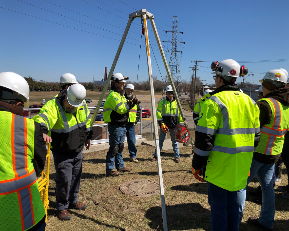
Geotechnical Investigation – The geotechnical field exploration for this project consisted of drilling three test borings. Our evaluation of the observed soil and groundwater conditions were published in a Report of Geotechnical Exploration.
In general, the soil conditions encountered during this exploration consist of an 8 ft to 14 ft layer of urban fill above a layer of native granular soil deposits to depths of up to 34.5 ft, which are underlain by an extensive stratum of native silty clay to the explored depth.
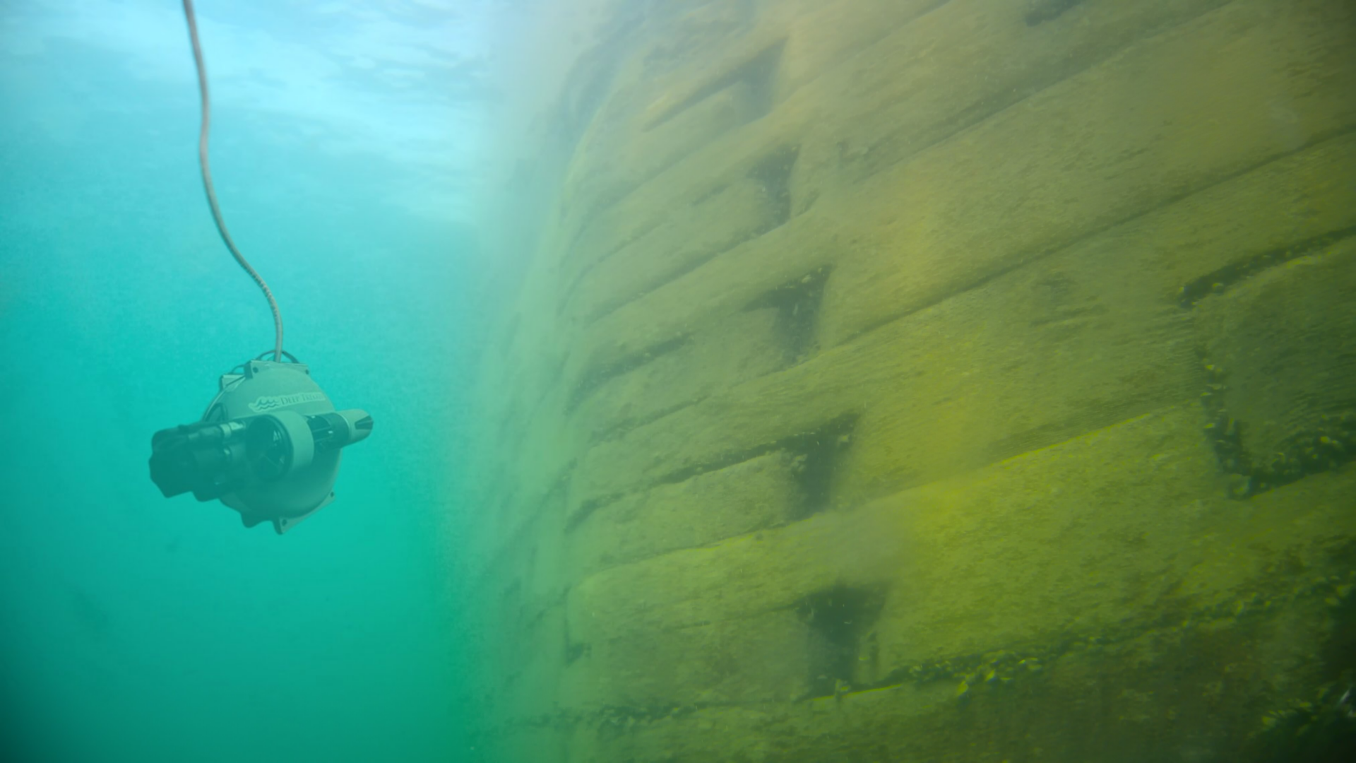
Shoreline and Dive Inspection – A dive inspection of the existing shoreline systems was performed by Commercial Diving and Marine Services, Inc. (CDMS) under the full-time observation of NTH field engineers. The supplied-air diver was assisted by a tender at the surface to ensure proper coordination of stationing with the dive video. Through a closed-circuit live feed video and audio, constant communication was maintained between the diver and the NTH engineer during the inspection, allowing for field conditions to be observed, discussed, and verified in real time throughout the inspection program. Station 0+00 was set at the upstream end of the park at the former dock east of the intake canal along the Detroit River.
In addition to the dive inspection, Sonar soundings at 25-ft intervals along the shoreline systems parallel to the flow of the Detroit River were obtained to observe the slope of the ground surface beneath and/or in front of the shoreline systems. Soundings were processed and measurements of the slope features were provided by CDMS. Findings, images, and sonar soundings from the study were provided to DTE in a Dive Inspection Observation Summary.
A shoreline inspection of the site was also performed by NTH between May 31 and June 6, 2022 as well as on October 29, 2022. The shoreline inspection included an investigation of the upland site features to denote locations of ground loss, structural deformation of the existing structures, and overall upland site conditions.
Client Benefit
NTH managed the inspection of the shoreline systems, which included documentation of the current shoreline condition above and below the water level and the preparation of an engineering report. DTE Energy is now able to address the shoreline concerns using the engineering report compiled by NTH.